Helsinki Airport (HEL)
Orientation and Maps
(Helsinki, Finland)
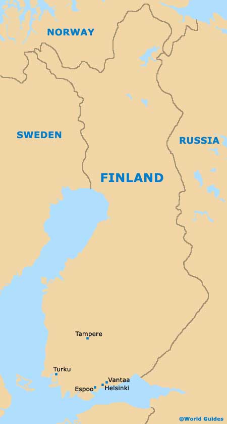
Located on the very southern side of Finland, Helsinki enjoys a peninsula setting and is almost completely surrounded by water and next to the Baltic Sea and also the Gulf of Finland. Helsinki is not only the biggest city in Finland, but it is also the capital, featuring a population of around 565,000.
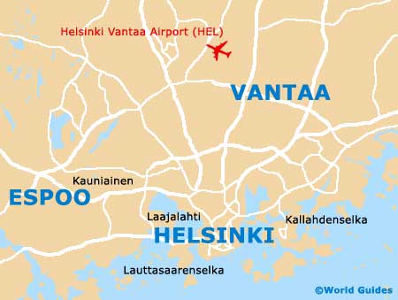
On the northern side of Helsinki and close to Vantaa is the Helsinki Vantaalla Airport (HEL), which is the country's premier airport and actually constructed for the city's successful Summer Olympics, which were held in the mid-20th century. More than 50 years on and the airport is as busy as ever, serving many international cities and being an important hub for local Finnair airlines.
Helsinki Vantaalla Airport (HEL) Maps: Important City Districts
Public transportation within Helsinki is good and features a light-rain system, subway 'Metro' trains, a network of trams, numerous bus lines and also two ferry routes, all of which are operated by Helsinki City Transport. All of these modes of transport mean that it is extremely easy to travel around the city and outlying areas.
Helsinki encompasses a series of surrounding peninsula areas and bays, with the heart of the city known locally as 'Vironniemi'. Situated on the eastern side of the Helsinki peninsula, the Kallio neighbourhood is just 1 km / 0.5 miles to the north of the downtown district and connected by the Pitkäsilta bridge.
Several islands surround the city and include Korkeasaari, home to the extremely popular Helsinki Zoo, which dates back to the latter part of the 19th century. This island is joined to the mainland by a bridge, linking the Mustikkamaa area.
Finland Map
Helsinki Map